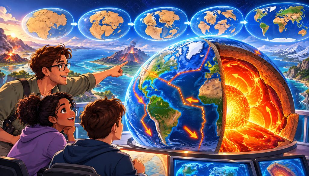
The continents may appear completely motionless, but the ground beneath our feet is constantly traveling across the planet. Europe, Africa, Asia, and the Americas are slowly changing their positions, reshaping oceans, mountain ranges, and coastlines.
Millions of years ago, Earth’s map looked almost unrecognizable. Continents that are now separated by enormous oceans were once connected, while familiar seas and mountain ranges had not yet formed.
The continents continue to move today, usually at speeds of just a few centimeters per year. Although this movement is too slow to notice directly, its effects become extraordinary over geological time.
Understanding why continents move reveals how our planet works, how ancient supercontinents disappeared, and what Earth’s geography may look like millions of years from now.
Why Do Continents Move?
The movement of continents is explained by plate tectonics, one of the most important theories in modern geology.
Earth’s outermost rigid shell, known as the lithosphere, is broken into large and small tectonic plates.
These plates include both continental and oceanic regions.
Beneath them lies the asthenosphere, a comparatively weak part of the upper mantle that can deform and flow extremely slowly over long periods.
The plates move across this underlying material, driven by forces associated with Earth’s internal heat and gravity.
Continents do not independently float across oceans. They travel as parts of enormous tectonic plates.
What Makes Tectonic Plates Move?
Earth retains heat from its formation approximately 4.54 billion years ago. Additional heat comes from the radioactive decay of elements within its interior.
This energy contributes to mantle convection, the extremely slow circulation and deformation of hot rock inside the planet.
Although mantle rock is predominantly solid, it can flow over millions of years under high temperatures and pressures.
Several processes contribute to plate movement:
- Slab pull: Cold, dense oceanic plates sink into the mantle and pull the remaining plate behind them.
- Ridge push: Gravity helps plates move away from elevated oceanic ridges.
- Mantle forces: Movement and stresses within the mantle interact with the plates above.
For many plates, slab pull is considered a particularly important driving force.
The result is a planet whose surface continually changes rather than remaining fixed.
How Fast Are the Continents Moving?
Most tectonic plates move at speeds ranging from a few millimeters to several centimeters annually.
Some move faster.
For example, parts of the Pacific Plate travel approximately 7–10 centimeters per year relative to certain reference frames.
The Atlantic Ocean is widening in many regions as the Americas move away from Europe and Africa.
Scientists can measure these movements directly using highly accurate satellite-based positioning technology.
Even a movement of three centimeters per year becomes approximately 30 kilometers over one million years.
Small annual movements can completely transform the arrangement of continents over hundreds of millions of years.
When All Continents Were Connected: Pangaea
Approximately 300 million years ago, most of Earth’s continental landmasses were joined together in an enormous supercontinent called Pangaea.
It stretched across a vast portion of the planet and was surrounded by the global ocean Panthalassa.
Pangaea contained regions that would eventually become modern Europe, Africa, Asia, Australia, Antarctica, and the Americas.
Its interior experienced strongly seasonal and often dry climatic conditions because many locations were far from the ocean.
Around 200 million years ago, Pangaea began breaking apart as tectonic forces gradually opened new ocean basins.
This breakup fundamentally transformed global geography.
How Pangaea Split Into Modern Continents
As Pangaea fragmented, its landmasses gradually separated into two major continental groups.
The northern group, Laurasia, included much of present-day North America, Europe, and Asia.
The southern group, Gondwana, contained Africa, South America, Antarctica, Australia, India, and other continental fragments.
These landmasses did not separate simultaneously.
The Atlantic Ocean gradually opened between the Americas and Africa and Europe.
South America and Africa continued drifting apart as new oceanic crust formed between them.
India later traveled northward and collided with Asia.
Australia separated from Antarctica and moved toward Southeast Asia.
By the time modern humans appeared, the continents had already reached broadly familiar positions.
The Continents Were Moving Long Before Pangaea
Pangaea was not Earth’s first supercontinent.
Geologists have identified evidence of even older continental assemblies, including Rodinia, which existed approximately one billion years ago.
The repeated formation and breakup of large continental groupings is known as the supercontinent cycle.
This cycle operates over hundreds of millions of years.
Continents collide, form enormous landmasses, break apart, and eventually participate in new collisions.
Scientists continue investigating the exact configuration and timing of Earth’s earliest supercontinents because ancient geological evidence is incomplete.
How New Oceans Form and Old Oceans Disappear
At the bottom of many oceans, tectonic plates are gradually moving apart.
Magma rises into the resulting openings, cools, and forms new oceanic crust.
This process is called seafloor spreading.
It commonly occurs along a mid-ocean ridge, an extensive underwater mountain system.
The Mid-Atlantic Ridge is a major example.
Elsewhere, oceanic crust is destroyed when one tectonic plate sinks beneath another.
This process, called subduction, carries oceanic lithosphere into the mantle.
Ocean basins can expand, shrink, or disappear entirely as tectonic plates rearrange Earth’s surface.
How Continental Movement Creates Mountains
Some of the world’s greatest mountain ranges formed through continental collisions.
Approximately 50 million years ago, the Indian continental plate began colliding with Eurasia.
The collision compressed and thickened the crust, contributing to the formation of the Himalayas and the Tibetan Plateau.
The process continues today.
The Himalayas are still being deformed by tectonic forces, although individual mountain elevations are also affected by erosion and other geological processes.
Continental collisions also helped build the Alps and many older mountain systems.
Mountain formation demonstrates how extremely slow plate movement can generate immense geological structures.
How Scientists Reconstruct Ancient Continents
Scientists use several kinds of evidence to determine where continents were located in the distant past.
Matching fossils provide important clues.
For example, fossils of the extinct freshwater reptile Mesosaurus have been discovered in both South America and southern Africa.
Matching geological formations also show that distant continents were once connected.
Another powerful method is paleomagnetism, which examines records of Earth’s ancient magnetic field preserved in rocks.
As certain rocks form, their magnetic minerals can record information about the magnetic field at that time.
Combined with geological dating and ocean-floor evidence, these measurements help researchers reconstruct ancient continental positions.
German scientist Alfred Wegener proposed continental drift in 1912, correctly recognizing that continents had moved.
However, he lacked a convincing physical explanation for the motion.
Later discoveries about the ocean floor and plate tectonics established the modern scientific framework.
How Continental Drift Affects Life and Climate
Continental movement influences much more than the shape of the world’s map.
As continents change position, ocean currents and atmospheric circulation can change too.
The formation of mountain ranges can alter rainfall patterns, creating wetter regions on one side and dry rain shadows on the other.
Tectonic activity also affects the long-term carbon cycle through volcanism, weathering, and interactions between rocks and the atmosphere.
Changing continental connections influence how animals and plants migrate and evolve.
The movement of tectonic plates also produces earthquakes, volcanic activity, and, in some circumstances, tsunamis.
Continental drift has helped shape Earth’s climate, ecosystems, biodiversity, and geological hazards throughout its history.
What Will Earth’s Continents Look Like in the Future?
The continents will continue moving for millions of years.
The Atlantic Ocean may continue widening for a considerable period, while parts of the Pacific Ocean are being consumed along subduction zones.
Africa is moving northward relative to Europe, contributing to tectonic deformation around the Mediterranean.
In eastern Africa, continental rifting is gradually separating sections of the African Plate.
Over millions of years, continued rifting could eventually create a new ocean basin.
Some researchers propose that Earth’s continents may assemble into another supercontinent in approximately 200–300 million years.
Possible future configurations have been given names such as Amasia and Pangaea Ultima.
These are scientific scenarios rather than guaranteed predictions.
The precise future arrangement depends on how plate boundaries and mantle processes evolve.
Interesting Facts
- South America and Africa were once connected, and their opposing coastlines retain a striking geometric resemblance.
- The Mid-Atlantic Ridge is part of a global oceanic ridge system extending approximately 65,000 kilometers.
- The Himalayas continue to experience active tectonic deformation because India is still converging with Eurasia.
- Fossils of the same ancient organisms found on different continents helped establish the evidence for continental drift.
- Antarctica once supported forests during warmer periods of Earth’s geological history.
- The Red Sea is a young ocean basin formed through the separation of the Arabian and African plates.
- Modern satellite measurements can detect tectonic plate movements of only a few millimeters per year.
Glossary
- Plate Tectonics — The scientific theory describing the movement and interaction of Earth’s rigid surface plates.
- Lithosphere — Earth’s rigid outer shell, consisting of the crust and uppermost mantle.
- Asthenosphere — A weak, slowly deforming region of the upper mantle beneath the lithosphere.
- Mantle Convection — Slow movement and deformation of mantle material associated with Earth’s internal heat.
- Supercontinent — An enormous landmass formed by the assembly of most continental regions.
- Pangaea — An ancient supercontinent that included nearly all modern continental landmasses.
- Laurasia — The northern continental grouping formed during the breakup of Pangaea.
- Gondwana — The southern continental grouping that included Africa, South America, Antarctica, Australia, and India.
- Supercontinent Cycle — The repeated assembly and fragmentation of large continental landmasses over geological time.
- Seafloor Spreading — The formation of new oceanic crust where tectonic plates move apart.
- Mid-Ocean Ridge — A long underwater mountain system associated with diverging tectonic plates.
- Subduction — The process in which one tectonic plate sinks beneath another into the mantle.
- Paleomagnetism — The study of ancient magnetic fields recorded in rocks and geological materials.