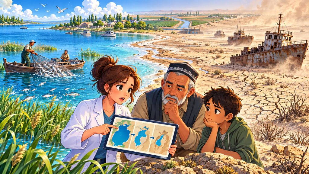
Once a vast inland lake surrounded by thriving fishing communities, the Aral Sea has become one of the most dramatic examples of human-caused environmental destruction.
Located between Kazakhstan and Uzbekistan in Central Asia, the Aral Sea was once the fourth-largest lake on Earth. Its waters supported fishing industries, moderated the local climate, and sustained communities for generations.
Today, much of that water has vanished, replaced by an enormous desert scattered with abandoned fishing boats.
The Aral Sea disaster demonstrates how poorly planned water management can transform an entire region within a single human lifetime.
Yet its story is not entirely one of destruction. Restoration efforts in Kazakhstan show that damaged ecosystems can sometimes recover.
What Was the Aral Sea Like Before the Disaster?
In 1960, the Aral Sea covered approximately 68,000 square kilometers.
Despite its name, it was actually a saltwater lake situated in an endorheic basin, a drainage system with no natural outlet to the ocean.
Two major rivers sustained it:
- The Amu Darya, flowing toward the southern part of the lake.
- The Syr Darya, supplying water to the northern part.
These rivers carried water from mountain ranges across Central Asia.
The lake supported commercial fisheries, wetlands, wildlife habitats, and coastal settlements.
Fishing ports such as Aralsk in Kazakhstan and Muynak in Uzbekistan were important centers of local economic activity.
How Did the Aral Sea Disaster Begin?
The roots of the catastrophe lie in Soviet agricultural policies.
During the 1950s and 1960s, Soviet authorities dramatically expanded irrigation systems across Central Asia.
Their primary objective was to increase cotton production, alongside other agricultural crops such as rice.
Water from the Amu Darya and Syr Darya was redirected into extensive networks of canals.
The enormous Karakum Canal, constructed through modern-day Turkmenistan, became one of the most significant examples of this transformation.
However, many irrigation channels were inefficient.
Large quantities of water evaporated or seeped into the ground before reaching agricultural fields.
As more river water was diverted, less remained to replenish the Aral Sea.
How Quickly Did the Aral Sea Disappear?
The decline accelerated over several decades.
By the late 1980s, the lake had lost roughly half its original surface area.
Its waters gradually separated into northern and southern sections.
The southern lake subsequently divided into eastern and western basins.
By the early 21st century, the original Aral Sea had lost approximately 90% of its water volume.
In 2014, satellite observations showed that the eastern basin of the South Aral Sea had completely dried out during the summer.
The remaining southern waters continued to fluctuate according to rainfall, snowmelt, and river inflow.
What had once appeared to be an almost endless body of water became a collection of shrinking lakes separated by desert.
The Birth of the Aralkum Desert
Perhaps the most striking consequence was the appearance of a completely new desert.
The former lakebed became the Aralkum Desert, covering tens of thousands of square kilometers.
Unlike many natural deserts, this landscape formed rapidly as water disappeared.
The exposed sediments contain large quantities of salt and, in some locations, residues associated with decades of agricultural activity.
Strong winds lift these materials into the atmosphere.
The resulting dust storms transport particles across surrounding settlements, farmland, and distant regions.
This is one reason the Aral Sea catastrophe extends far beyond its original shoreline.
Environmental Damage Beyond the Disappearing Water
As the lake shrank, its salinity increased dramatically in many remaining areas.
Fish species that could previously survive in the water struggled as salt concentrations rose.
Wetlands deteriorated, aquatic habitats disappeared, and wildlife populations declined.
The retreat also altered the region’s microclimate, the climatic conditions experienced within a particular local environment.
The large water body had previously helped moderate seasonal temperature extremes.
Without that influence, surrounding areas experienced greater temperature fluctuations and changes in growing conditions.
Meanwhile, salt deposited on agricultural land contributed to soil salinization, reducing fertility and making farming more difficult.
The Human Cost of the Aral Sea Catastrophe
The environmental disaster quickly became an economic and social crisis.
Fishing communities lost their livelihoods as commercial fish populations collapsed.
During the early 1960s, the Aral Sea supported a fishing industry employing tens of thousands of people.
By the early 1980s, commercial fishing across the original lake had largely disappeared.
Muynak became an internationally recognized symbol of the disaster.
Once a functioning port, the town found itself separated from the retreating shoreline by a vast expanse of dry land.
Abandoned fishing vessels now stand in the surrounding desert.
Residents also faced worsening environmental conditions, including airborne dust, declining water quality, and agricultural difficulties.
The disaster affected not only nature but employment, public health, food security, and entire communities.
Expert Perspective: A Preventable Environmental Collapse
Geographer Philip Micklin, a longtime Aral Sea researcher associated with Western Michigan University, has extensively studied the lake’s decline.
His research emphasizes the relationship between river diversion, agricultural water demand, and the changing size of the Aral Sea.
He has also explained how the remaining southern waters can fluctuate significantly with changes in river flow and mountain precipitation.
The central lesson is that the disaster was driven primarily by human decisions about water allocation, rather than by an unavoidable natural process.
Although the Aral Sea experienced natural fluctuations throughout history, the extraordinarily rapid modern collapse was fundamentally different in scale and cause.
How Kazakhstan Began Restoring the North Aral Sea
The northern section offers one of the most encouraging examples of environmental recovery.
In 2005, Kazakhstan completed the Kok-Aral Dam with international financial support.
The structure helped retain water from the Syr Darya in the North Aral Sea rather than allowing it to drain southward.
The results were significant.
Water levels rose, salt concentrations decreased, and aquatic ecosystems began recovering.
Between 2004 and 2007, reported annual fish catches increased from approximately 50 tonnes to around 2,000 tonnes.
Fishing operations and related employment gradually returned.
The North Aral Sea demonstrates that targeted restoration can revive ecosystems once considered nearly lost.
However, this achievement does not mean that the entire original lake has recovered.
Can the Southern Aral Sea Be Saved?
Restoring the much larger southern basin remains considerably more difficult.
The Amu Darya continues to supply extensive agricultural systems, while regional water demand remains high.
Simply rebuilding the original lake would require enormous and sustained changes in river-water allocation.
Consequently, environmental projects increasingly focus on reducing damage and improving local living conditions.
One important approach involves planting saxaul, a drought-resistant desert shrub or small tree.
Its extensive roots help stabilize loose sediments and reduce wind erosion.
In 2025, a restoration initiative in Uzbekistan planted approximately 80,000 saxaul seedlings across 80 hectares of exposed seabed.
Such projects cannot replace the vanished lake, but they can help limit the spread of dust and restore vegetation to damaged landscapes.
What Can the World Learn From the Aral Sea?
The disaster illustrates the importance of protecting entire river systems rather than considering individual agricultural projects in isolation.
Modern sustainable water management requires balancing agricultural production, human consumption, environmental needs, and long-term water availability.
More efficient irrigation systems can reduce waste, while careful crop selection can lower water demand in dry regions.
Regional cooperation is equally important because rivers cross national borders.
The history of the Aral Sea is therefore relevant to other areas experiencing water shortages, intensive agriculture, and growing environmental pressure.
The most important lesson is that preventing ecosystem destruction is far less costly than attempting to repair it afterward.
Interesting Facts
- In 1960, the Aral Sea was the world’s fourth-largest lake by surface area.
- The Aral Sea was originally sustained by two major rivers flowing from distant mountain systems.
- The newly formed Aralkum Desert is among the world’s youngest large deserts.
- During the summer of 2014, the eastern basin of the South Aral Sea completely dried out.
- Muynak, once a busy fishing port, is now famous for abandoned ships surrounded by desert.
- The Kok-Aral Dam helped restore freshwater fish populations in the northern lake.
- Saxaul can survive extremely dry, salty conditions, making it valuable for stabilizing the former seabed.
- The northern and southern sections now have dramatically different environmental conditions and restoration prospects.
Glossary
- Endorheic Basin — A drainage basin where water collects inland without flowing into an ocean.
- Irrigation — The artificial application of water to agricultural land to support crop growth.
- Aralkum Desert — The desert that formed across large areas of the exposed Aral Sea lakebed.
- Dust Storms — Weather events in which strong winds carry large amounts of dust and loose particles through the atmosphere.
- Salinity — The concentration of dissolved salts in water.
- Microclimate — The climate of a specific small area, which may differ from surrounding conditions.
- Soil Salinization — The accumulation of salts in soil, potentially reducing agricultural productivity.
- Kok-Aral Dam — A dam in Kazakhstan constructed to retain water and support the recovery of the North Aral Sea.
- Saxaul — A drought-resistant desert plant used to stabilize sandy soils and reduce wind erosion.
- Sustainable Water Management — The responsible use and protection of water resources to support both present and future needs.