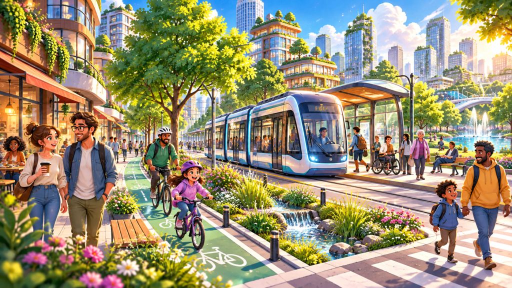
Imagine living in a city where schools, parks, shops, and healthcare facilities are just a short walk away. Streets are safe, public transportation is reliable, and green spaces are integrated into everyday life.
Instead of spending hours in traffic, residents can easily travel by tram, bus, bicycle, or on foot.
This vision is already becoming reality in some of the world’s most innovative cities.
Urban planners are increasingly rethinking traditional development models that prioritize private cars and extensive road networks.
The new approach focuses on accessibility, environmental sustainability, and quality of life.
A truly successful modern city is not simply one that moves vehicles efficiently. It is one that helps people live comfortably while protecting the natural environment.
What Makes a City People-Friendly?
A people-friendly city is designed around everyday human needs.
Residents should be able to reach essential services without depending entirely on private vehicles.
This principle is closely connected to walkability, which describes how convenient, safe, and pleasant an area is for pedestrians.
Walkable neighborhoods typically feature connected sidewalks, safe crossings, accessible public spaces, and nearby destinations.
Another essential element is mixed-use development.
Instead of separating residential neighborhoods from offices, shops, and services, mixed-use areas bring different activities closer together.
This reduces unnecessary travel and creates lively streets throughout the day.
The most convenient cities minimize the distance between where people live and where they need to go.
The 15-Minute City: Everyday Life Within Easy Reach
One influential urban planning concept is the 15-minute city.
The idea is that residents should be able to reach many essential daily destinations within approximately 15 minutes by walking or cycling.
These destinations may include:
- Grocery stores and local markets
- Schools and childcare facilities
- Parks and recreational areas
- Healthcare services
- Cafes, shops, and workplaces
- Public transportation connections
The concept does not eliminate longer journeys or restrict movement.
Instead, it provides more convenient options for everyday activities.
Paris has incorporated elements of this approach into its urban planning, including improved cycling infrastructure and neighborhood public spaces.
Public Transportation as the City’s Backbone
A city designed for people needs efficient public transportation.
Buses, trams, metro systems, and suburban trains can move large numbers of passengers while using urban space more efficiently than private cars.
An important planning principle is transit-oriented development.
This approach concentrates housing, workplaces, and essential services around well-connected public transportation stations.
Residents can therefore reach destinations without needing a car for every journey.
Another effective solution is bus rapid transit (BRT).
BRT systems combine features such as dedicated bus lanes, convenient stations, and priority at intersections to improve speed and reliability.
Bogotá’s TransMilenio system and Curitiba’s bus network demonstrate how buses can play a central role in large urban transportation systems.
Public transportation becomes attractive when it is frequent, affordable, accessible, and reliable.
Streets Should Serve More Than Cars
Traditional street design often focuses primarily on vehicle movement.
However, streets also serve pedestrians, cyclists, businesses, public transportation passengers, and local communities.
The concept of complete streets encourages designers to consider all these users.
A well-designed street may include protected bicycle lanes, wide sidewalks, dedicated bus lanes, trees, and safe pedestrian crossings.
The goal is not necessarily to remove cars entirely.
It is to provide safe and practical alternatives.
The concept of induced demand also helps explain why expanding roads does not always solve traffic congestion.
Additional road capacity can encourage more driving, eventually reducing the expected congestion benefits.
Why Urban Nature Is Essential
Nature is not merely decorative.
Trees, parks, wetlands, and green corridors provide important environmental and social benefits.
The term green infrastructure describes natural and semi-natural systems designed to support urban environments.
Examples include street trees, rain gardens, vegetated roofs, and restored waterways.
These features can:
- Provide shade and cooling
- Support birds and pollinating insects
- Improve stormwater management
- Create recreational opportunities
- Help filter certain air pollutants
- Improve the appearance of neighborhoods
Green spaces also create opportunities for physical activity and social interaction.
Urban nature should be treated as essential infrastructure rather than an optional luxury.
How Green Cities Fight Heat and Flooding
Cities often experience higher temperatures than surrounding rural areas.
This phenomenon is known as the urban heat island effect.
Concrete, asphalt, and buildings absorb and retain heat, while limited vegetation reduces natural cooling.
Planting trees and creating shaded public spaces can help lower local temperatures.
Cities must also manage heavy rainfall.
Traditional paved surfaces prevent much of the rainwater from entering the soil.
Permeable pavements allow water to pass through certain surfaces and infiltrate suitable underlying layers.
When combined with rain gardens, green spaces, and drainage systems, they can reduce stormwater runoff.
However, these measures require appropriate soil conditions, maintenance, and careful engineering.
Housing, Accessibility, and Social Equality
A sustainable city must also be affordable and inclusive.
Excellent transportation and beautiful parks provide limited benefits if only wealthy residents can live nearby.
Housing policies therefore play an important role in urban planning.
Cities can encourage a variety of housing types, including apartments, townhouses, and affordable rental homes.
Another essential concept is universal design.
This means designing environments that can be used by people with different ages and abilities.
Step-free transportation access, accessible pedestrian crossings, benches, and clear pathways help older adults, children, wheelchair users, and people with temporary injuries.
A city cannot be considered truly people-friendly if significant groups of residents face barriers to participating in everyday life.
Real Cities Already Demonstrating Better Urban Design
Several cities offer practical examples of people-centered planning.
Copenhagen, Denmark, has developed extensive cycling infrastructure that makes bicycles a practical transportation option for everyday journeys.
Utrecht, Netherlands, integrates cycling routes with railway stations, allowing residents to combine bicycle and train travel.
Barcelona, Spain, has introduced superblocks that reorganize selected streets to reduce through-traffic and provide more room for pedestrians and public activities.
Curitiba, Brazil, became internationally known for integrating bus transportation with urban development.
These cities differ in geography, population, and infrastructure.
Their common lesson is that urban improvements work best when transportation, land use, and public spaces are planned together.
Expert Perspective: Designing Cities at a Human Scale
Danish architect and urban design expert Jan Gehl has spent decades studying how the built environment influences human behavior.
His work emphasizes the importance of designing public spaces around walking, social interaction, and the everyday experience of city residents.
Gehl’s human-scale approach encourages planners to consider how streets and buildings feel to people moving at pedestrian speeds.
This perspective helped influence urban design discussions internationally.
Successful urban planning should begin with human experience rather than treating people as secondary to transportation infrastructure.
How Can We Measure a Successful City?
Urban success should not be measured only through economic growth or road construction.
Planners can evaluate modal share, the proportion of journeys made using different transportation methods.
Other useful indicators include public transportation reliability, access to parks, average travel times, housing affordability, and traffic safety.
Environmental measurements such as air pollution, urban temperatures, and stormwater performance also matter.
These indicators help cities identify weaknesses and evaluate improvements.
The ultimate objective is straightforward: create neighborhoods where people can move easily, enjoy healthy environments, and access opportunities without unnecessary dependence on private cars.
Interesting Facts
- Copenhagen is internationally recognized for its extensive bicycle transportation infrastructure.
- Utrecht has built one of the world’s largest bicycle parking facilities near its central railway station, with approximately 12,500 spaces.
- Barcelona’s superblock projects demonstrate how reorganizing street traffic can create additional public space.
- Curitiba began developing its pioneering bus rapid transit network in the 1970s.
- Urban trees can reduce local heat exposure through shade and evaporation of water.
- Dedicated bus lanes can improve transportation reliability by reducing interference from general traffic.
- Compact neighborhoods can reduce travel distances when housing, employment, and services are located close together.
- Accessible street design benefits not only people with disabilities but also families with strollers, travelers carrying luggage, and older residents.
Glossary
- Walkability — The degree to which an area is safe, comfortable, and convenient for pedestrians.
- Mixed-Use Development — Urban planning that combines residential, commercial, and other activities within the same area.
- 15-Minute City — A planning concept encouraging convenient access to essential daily services within a short walk or bicycle ride.
- Transit-Oriented Development — Urban development that concentrates housing, workplaces, and services around public transportation.
- Bus Rapid Transit (BRT) — A high-capacity bus transportation approach using infrastructure and operations designed to improve speed and reliability.
- Complete Streets — Streets designed to accommodate pedestrians, cyclists, public transportation, and motor vehicles safely.
- Induced Demand — The tendency for additional transportation capacity to generate more travel, potentially offsetting congestion reductions.
- Green Infrastructure — Natural and semi-natural systems that provide environmental benefits and support urban services.
- Urban Heat Island — The phenomenon in which built-up urban areas experience higher temperatures than nearby less-developed surroundings.
- Permeable Pavements — Surfaces designed to allow water to pass through them, helping manage rainfall and runoff.
- Universal Design — An approach to designing spaces and services that are accessible and usable by people with diverse abilities.
- Modal Share — The percentage of total journeys made using each transportation method, such as walking, cycling, public transit, or driving.