Early warning systems (EWS) are critical tools designed to reduce the impact of natural and man-made disasters by providing advance alerts to populations and emergency responders. These systems integrate real-time data collection, risk analysis, and communication technologies to issue timely alerts. The ultimate goal is to save lives, minimize damage, and support swift decision-making during crises. As climate change increases the frequency and intensity of disasters, the role of EWS has become more vital than ever.
Main Components of Early Warning Systems
A complete early warning system typically consists of four interconnected components: risk knowledge, monitoring and forecasting, communication, and response capability. Risk knowledge involves understanding hazards (like earthquakes or floods), assessing vulnerable populations, and mapping at-risk areas.
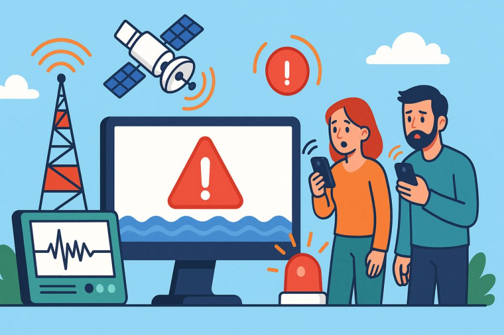
Monitoring and forecasting rely on sensors, satellites, weather radars, seismographs, and hydrological gauges to detect changes in environmental conditions. Communication systems ensure that warnings reach the public quickly through mobile alerts, sirens, radio, television, and social media. Finally, response capability includes the readiness of emergency services, evacuation plans, and public education.
Technologies Behind Detection and Forecasting
Different hazards require specialized detection tools. Seismographs detect ground motion caused by earthquakes and can trigger alerts seconds before destructive waves arrive. Tsunami buoys and ocean-bottom pressure sensors monitor sea level changes to issue alerts following seismic activity.
For hurricanes and typhoons, satellite imagery, doppler radar, and numerical weather models are used to forecast storm paths and intensity. Flood detection systems employ rainfall sensors and river-level gauges, while wildfire early warning systems use thermal imaging, lightning detectors, and AI-based smoke recognition from satellites.
Data Integration and Decision Support
Modern EWS depend heavily on data integration platforms and geographic information systems (GIS). These tools compile information from multiple sources to generate real-time maps and predictive models. Artificial intelligence (AI) and machine learning enhance forecasting accuracy by analyzing historical and real-time data patterns.
Decision-support systems then process this data to guide public authorities in issuing alerts, deploying rescue resources, and activating evacuation protocols. Accuracy and speed are vital, as even a few minutes of warning can significantly reduce casualties and damage.
Communication and Public Outreach
Once a threat is identified, it must be communicated to the public clearly and quickly. In many countries, cellular broadcast systems send emergency alerts to all mobile phones in a danger zone. Tornado sirens, television interruptions, and digital billboards also serve as effective communication tools.
Public education plays a crucial role in ensuring people know how to interpret and act on warnings. Drills, signage, and school programs help build community resilience and ensure that warnings lead to effective action rather than confusion or panic.
Limitations and Challenges
Despite advancements, early warning systems face challenges. In remote or underdeveloped regions, lack of infrastructure can delay detection or communication. Language barriers, misinformation, and technological limitations may hinder public response. Furthermore, false alarms or delayed alerts can erode public trust.
Climate change is also introducing unpredictable weather patterns, straining traditional forecasting models. To address these challenges, many countries are investing in multi-hazard early warning systems that integrate forecasts for floods, fires, earthquakes, and other threats into a unified platform.
Global Efforts and Cooperation
International collaboration plays a key role in enhancing EWS. Organizations like the World Meteorological Organization (WMO), UNDRR (United Nations Office for Disaster Risk Reduction), and Global Seismographic Network support data sharing and capacity building in developing nations.
Programs like the “Early Warnings for All” initiative aim to provide global coverage by 2027, ensuring every person on Earth is protected by a functional early warning system. These efforts combine science, technology, governance, and community participation to create a safer world for all.
Conclusion
Early warning systems represent a powerful intersection of technology, science, and public safety. When properly designed and implemented, they give populations valuable time to prepare for and survive natural disasters. Continued investment, innovation, and education are essential to strengthen these systems in the face of evolving global threats.
Glossary
- Early Warning System (EWS) — a coordinated set of tools and processes to detect hazards and inform the public
- Seismograph — a device that records ground motion caused by earthquakes
- Geographic Information System (GIS) — software that analyzes and visualizes geographic and spatial data
- Machine learning — an AI method where computers learn from data patterns without being explicitly programmed
- Risk knowledge — understanding the types and likelihood of hazards in a specific area
- Multi-hazard system — a warning system that integrates multiple types of hazards into one platform
- Community resilience — the ability of a population to anticipate, respond to, and recover from disasters